Introducing The Skocjan Caves
Skocjan Caves or Skocjanske Jame as the cave system is called in Slovene is one of the top tourist attractions in Slovenia situated in the southwestern corner of the country near the town of Divaca. The cave is the creation of the Reka River. Due to its extraordinary importance, the cave was entered on UNESCO’s list of natural and cultural world heritage sites in 1986. In 1999, the Cave was entered on the Ramsar Directory of Wetlands of International Importance and in 2004, the Skocjan Caves Park was included in the world network of biosphere reserves called MAB (Man and the Biosphere).
Skocjan Caves Review
Skocjan Caves is a spectacular cave system in southwest Slovenia with nice stalactites, stalagmites, and other interesting rock formations, but what sets this cave apart from other caves is the underground Reka river and the largest discovered underground cavern in all of Europe (and one of the largest in the world). The cavern is of colossal proportions and it’s hard to believe it’s real and not some computer-generated imagery from Lord of the Rings – when you get to the cavern with a river running way below it seriously feels like you’ve been transported into Tolkien’s Lord of the Rings and you are about to witness the battle between Gandalf and the Balrog – the chamber is that huge. The cave is several million years old and due to its exceptional significance, the Skocjan Caves are a UNESCO protected site since 1986.
There is a 10 minute walk in the open to the actual entrance of the cave. At the entrance, the guides split the group depending on the language (English, German, Italian, Slovenian, etc.) into smaller groups of 30 or so visitors and then lead the group into the cave. There are five main stops in the cave where the guide explains the area and points out interesting formations with a flashlight. The path is well lit, has railing all along one side and is fairly even and paved. You walk for nearly 2 hours (it’s a 2 kilometre walk in all). It’s not a difficult walk through the cave but there are plenty of steps and some uphill bits, so this would be quite a tiring experience for older ones or toddlers. For the fit and healthy, no problem, but good walking shoes with a good grip are a must. It is also helpful to have a cap to shield you from the dripping water from above. There are large noisy waterfalls within the cave and it’s really exciting to walk on the bridges from one side to the other and on the walkways around the huge caverns with incredible views all around. If you suffer from acrophobia, it’s pretty scary which is hard to believe when you are underground. However, the infrastructure is first rate with very secure pathways and railings. There is a cable car at the end to take you back to the top and save you a long climb back, but we still recommend you to walk all the way back to the information centre versus taking the cable car up, because there’s still a lot to see after the tour and on your way back including a wonderful waterfall. After a bit of rest, you also have an option to continue the tour on trail number 2 and follow the path of the underground Reka river raging through the cave. This is much shorter tour than the main tour and can be completed in under 50 minutes or so. There is no photography allowed as Skocjan is a UNESCO site until you get to the exit of the cave. The cave is cool but not cold and most people wear jackets – it’s 12°C in dry areas and 0-20°C in areas with flowing water. There is a restaurant and souvenir shop on the property for a meal after you are done.
All in all, Skocjan Caves are absolutely amazing and must be visited if in the region. The immensity of the Skocjan cave is unique and what makes it protected by UNESCO. You will never see such an enormous cavern in the rest of Europe, let alone walk across it on a bridge. However, if you are looking for magnificent stalactites, stalagmites and other interesting rock formations and would like to take pictures in the cave, you should head straight to the Postojna cave (it’s also a fantastic cave system).
Visit to Skocjan Cave is possible 365 days per year. Timetable of visits (you should arrive at least 15 minutes early to get tickets, use restroom and get to meeting area):
January, February, March, November, December: 10:00, 13:00
April, May, October: 10:00, 13:00, 15:30
June, July, August, September: 10:00, 11.00, 12:00, 13:00, 14:00, 15:00, 16:00, 17:00
The guided tour through the cave costs €16 for adults, €12 for seniors and students, and €7,5 for children. The extended tour (main tour through the cave + following the Reka River underground) costs €21 for adults, €16 for seniors and students, and €11 for children.

Skocjan Caves Pictures
View our image gallery with 30 high-resolution photos that prove you absolutely have to visit Skocjan Caves!
20 photos below by Borut Lozej, Archives Park Skocjanske Jame
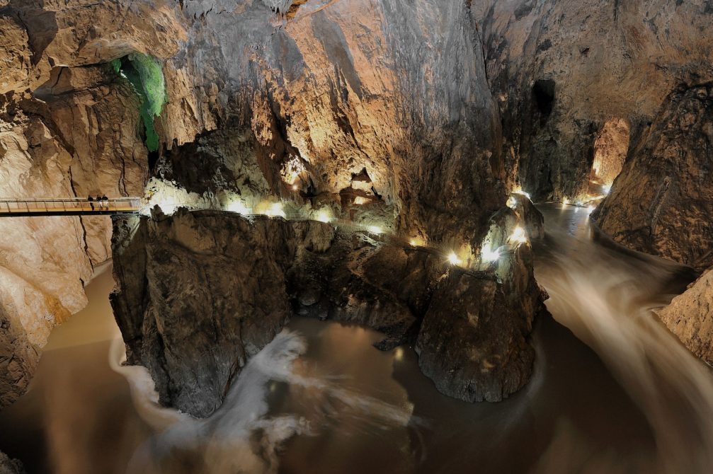
The Skocjan Cave stands out for several reasons, including the largest underground cavern in all of Europe with a rushing underground river at the bottom. Flooding can be an issue here but park officials carefully monitor weather reports.
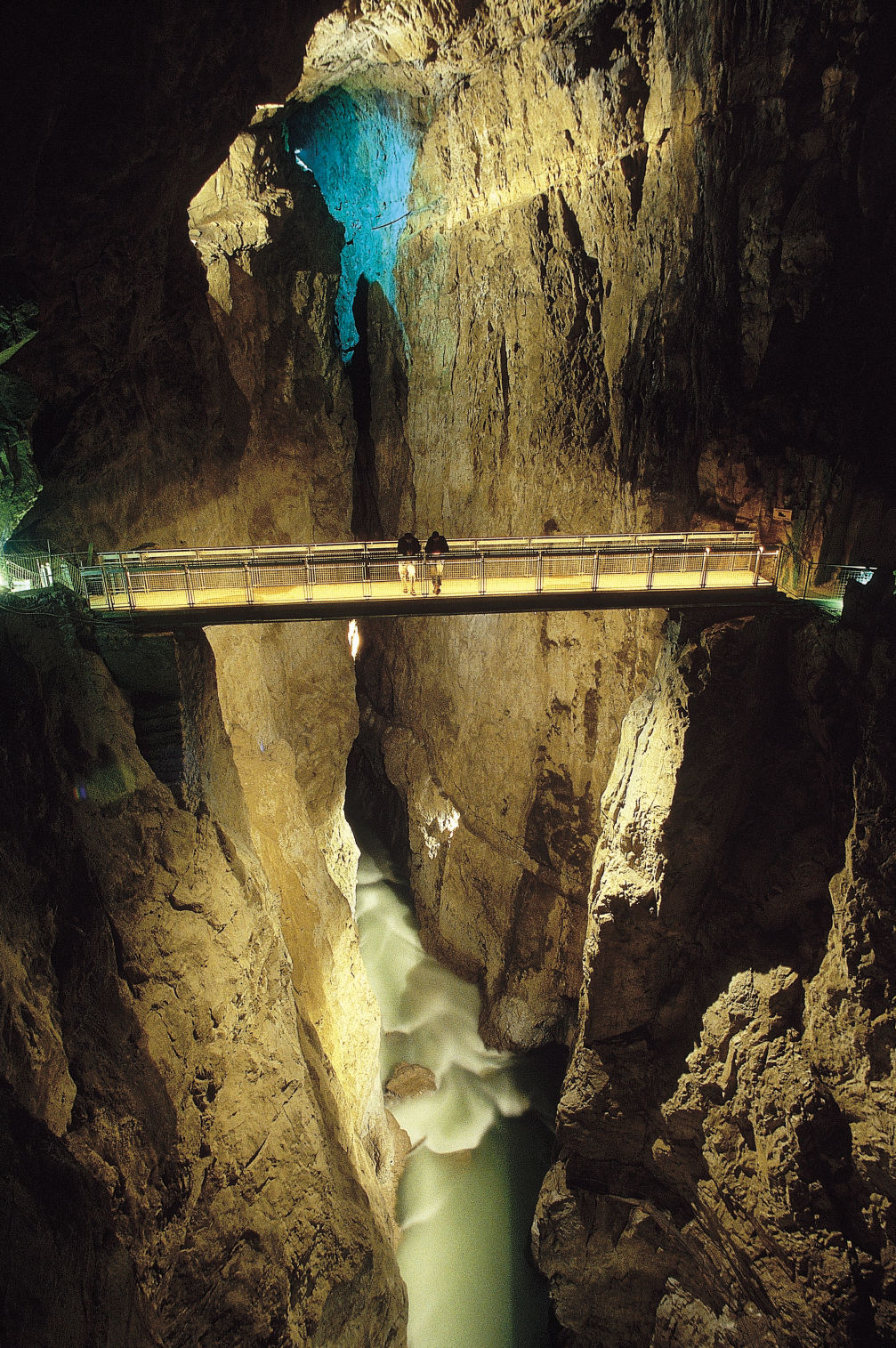
The Reka river flows through the underground canyon under the Cerkvenik Bridge, suspended 47 meters above the riverbed, which is definitely the highlight of the trip. The river then continues its course along Hanke’s Canal. This underground canal is about 3.5 kilometres long, 10 to 60 meters wide and over 140 meters high.

Lighted pathways mark the path through the cave.
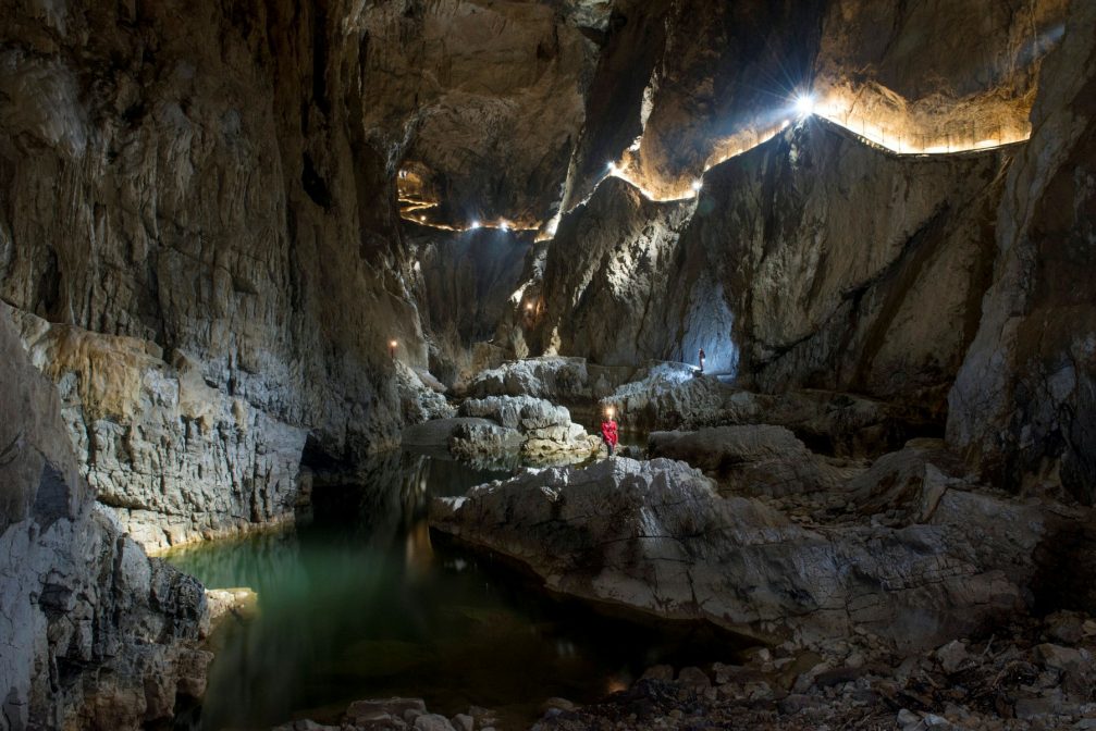
Lighted pathways alongside the Reka River.
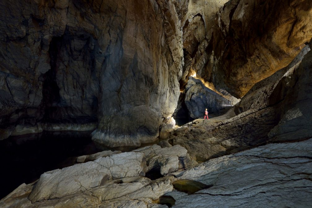
The extraordinary underground canyon of the Reka River inside the cave.

Some stalactites and stalagmites are so unique that they’ve been nicknamed. ‘Romeo and Juliet’ are two stalagmites in the Velika Dvorana hall.
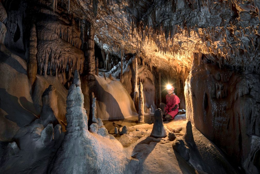
Stalagmites and stalagtites in the Paradise section of the cave.
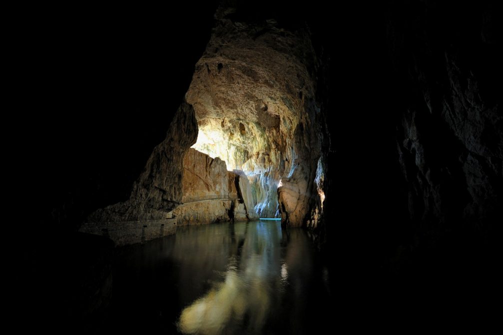
The pathways through Mahorcic cave allow visitors to move deep into the subterranean world.
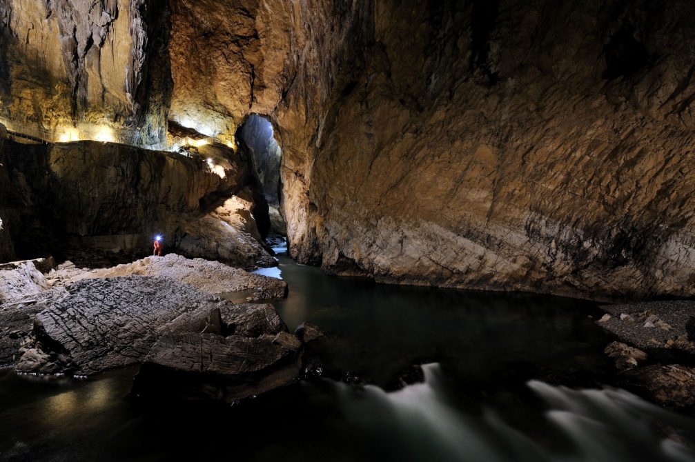
The underground canyon of the Reka river inside the Svetina’s Hall.
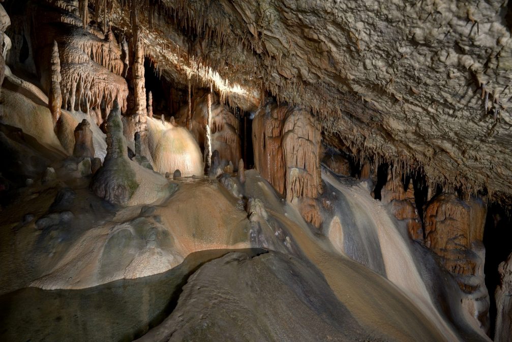
Stalagmites and stalactites in the cave.

Unique stalactites that hang from the ceiling.
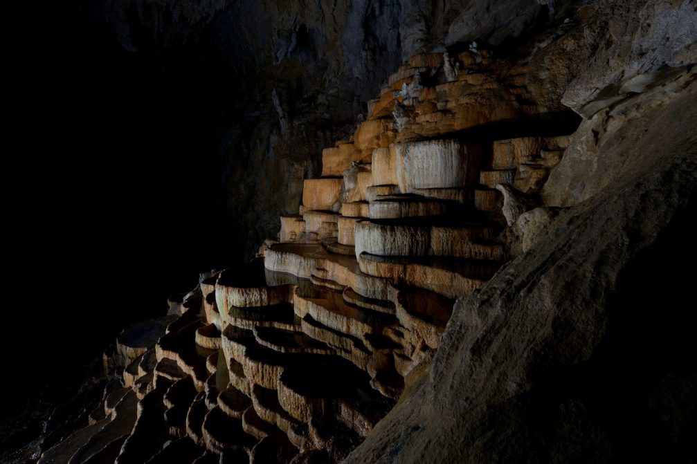
The Bowls Hall, terraced potholes shaped by the water running down into the canyon.
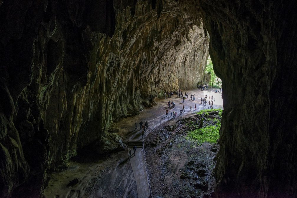
Schmidl Hall, the final section, emerges into the Velika Dolina. From here you walk past Tominc Cave, where finds from a prehistoric settlement have been unearthed.

The exit of the cave and entrance back into the gorge.
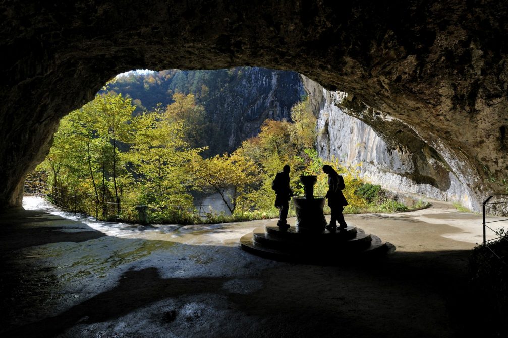
In the middle of the entrance to the Tominc Cave is a well dating back to 1889, dedicated to the Viennese Karstologist Franz Kraus.
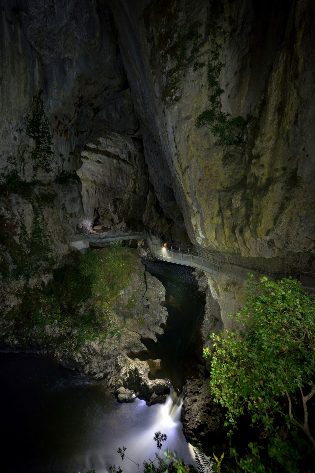
A recent addition to the cave trail, this metal bridge replaced an older one that was washed away during flooding in 2011.
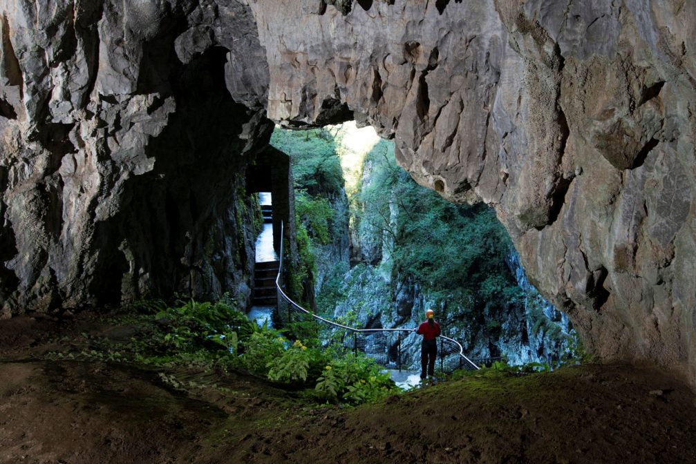
Path through the canyon, hacked out of the rocky cliffs.
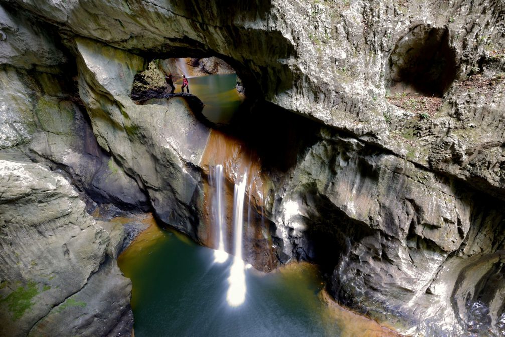
Waterfalls of the Reka river in the collapsed doline, before the river enters the underground canyon.

A view of the small lake from the outside.
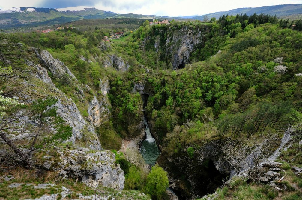
Big Collapse Doline and Little Collapse Doline at Skocjan with the village of Skocjan on the other side. The cave entrances are at the bottom of the two collapse dolines.
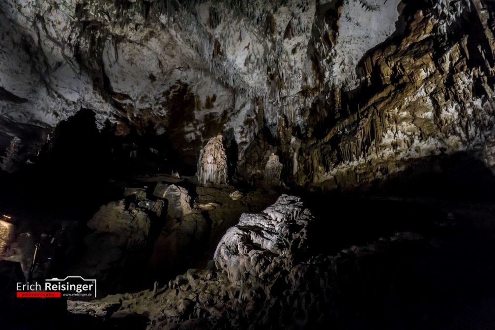
Next 5 photos below by Erich Reisinger
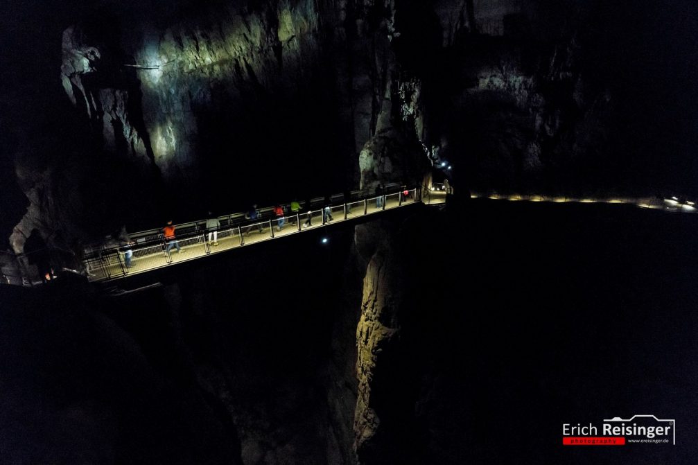
The Cerkvenik Bridge, 47 meters above the Reka River.
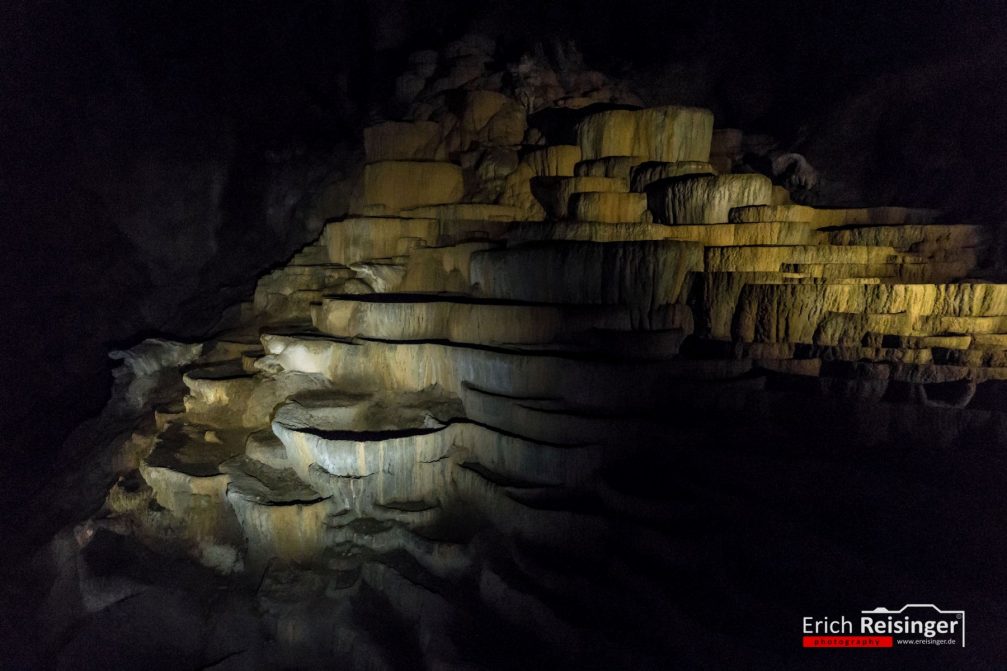
Terraces of precipitated calcium carbonate inside the caves.
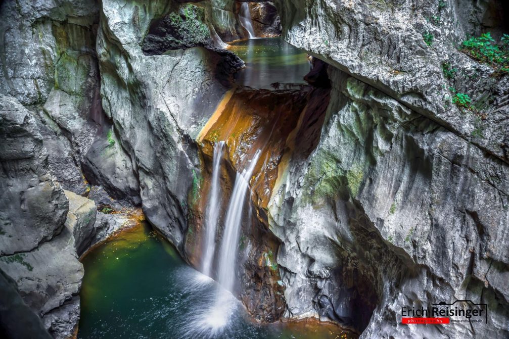
The Caves are the creation of the Reka River.
Next 7 photos below by Jost Gantar, Slovenia.info!
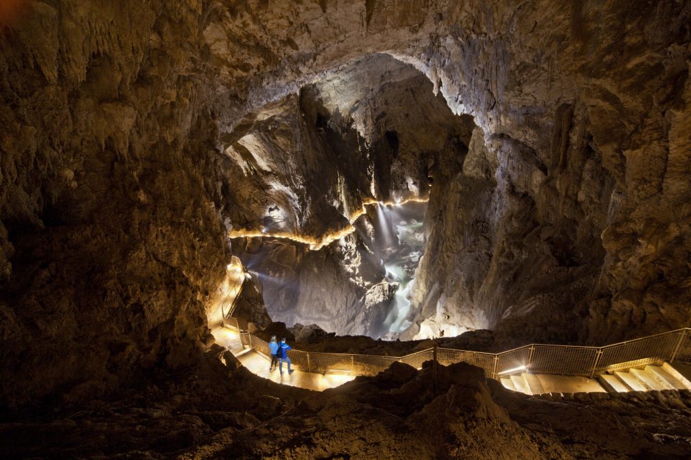
The cave is absolutely fabulous with all the normal cave items, what makes it extra special is the size of some of the chambers, they are enormous.
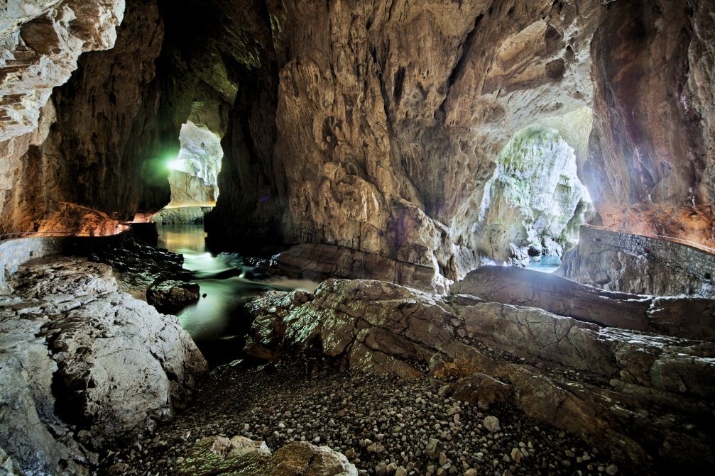
The underground Reka river flowing inside the cave.

The magical underground world you can’t help admiring.
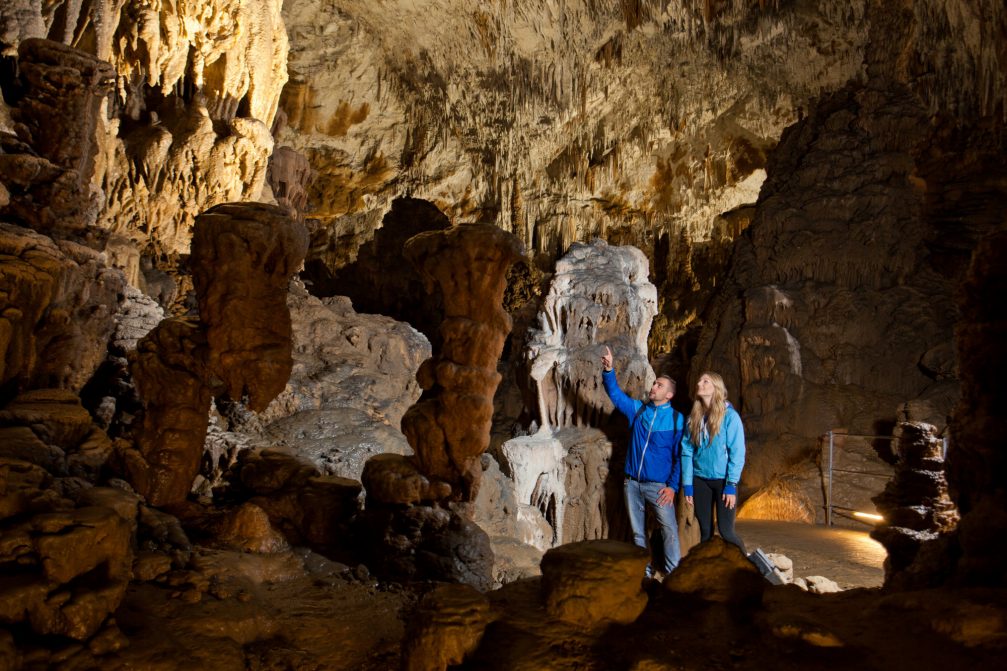
The sights are amazing with so much to see in the way of different rock formations, colours, pools, waterfalls and a river.

The natural formations are awe inspiring and the sheer size of the caves is amazing.

Terraces of precipitated calcium carbonate are very interesting to look at.
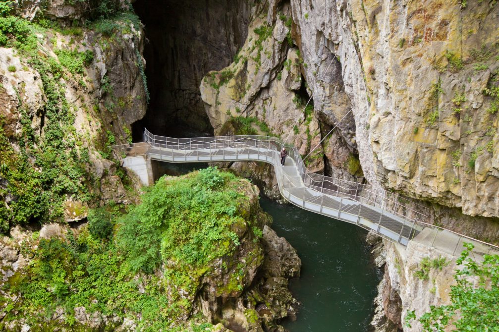
This place is nature at its mighty best, possibly not the most picturesque cave in Slovenia but certainly the most impressive.
For more beautiful photos visit our picture gallery: 30 Beautiful Skocjan Caves Photos to Inspire Your Next Trip!
Skocjan Caves location on the map
Address: Matavun 12, 6215 Divaca, Slovenia
Latitude and Longitude coordinates: 45.663168, 13.989321
GPS coordinates: 45° 39′ 47.4048” N 13° 59′ 21.5556” E
Region: Littoral


